
Calvert Tungsten Project
Location
Mithril’s 100% owned Calvert Tungsten property comprises 18 lode claims covering a total area of 360 acres. Additionally, two satellite historical prospects, the Calvert South and the White Cap, are located within 2 miles of the Calvert, comprising of 120 acres and 40 acres, respectively.
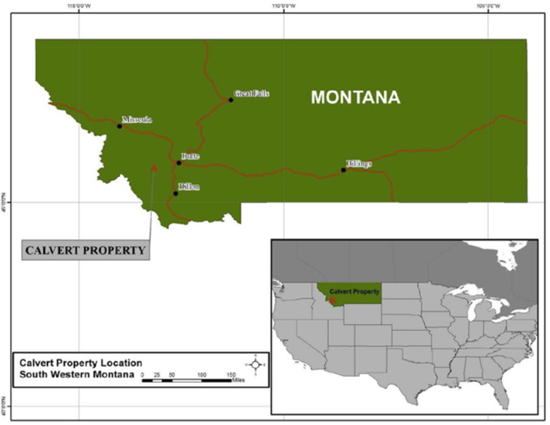
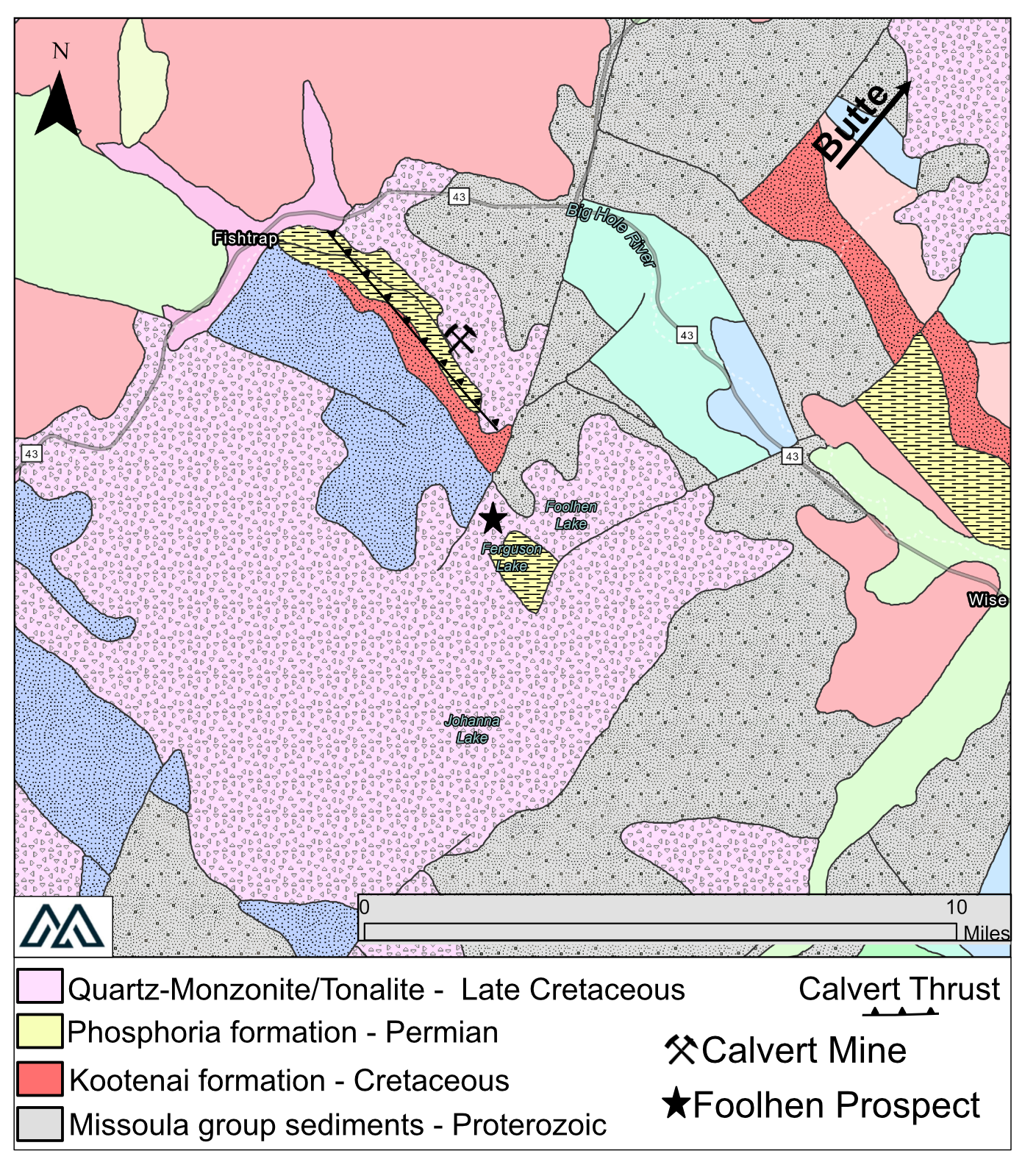
The Calvert is located in Beaverhead County, MT located approximately 40 miles southwest of Butte, within Section 12, Township 1 North, Range 13 West and Centered on 45.854N Latitude and 113.158W Longitude at an elevation of 6,975 feet.
The nearest community to the project area is the unincorporated community of Wise River, located approximately 40 miles to the southwest of Butte. The community has a school, church, post office, two bars/cafes and a general store.
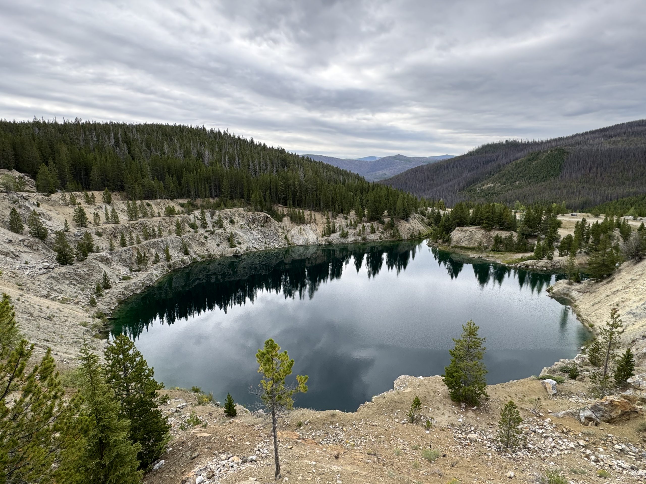
At the present time the Calvert Mine open pit is flooded to a depth of 70 feet. There is no infrastructure remaining on site. Historic milling of ores from the mine were performed off site.
Production History
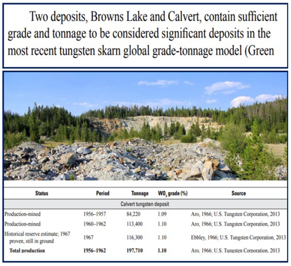
The Calvert Mine was discovered in 1956 by two prospectors and in 1956, Minerals Engineering Company of Grand Junction Colorado leased the property and started exploration work. The property began production in 1957 and continued until 1958, when the U.S. Government stopped purchasing Tungsten. During this period, 92,837 tons of ore was mined, averaging 1.09% WO3.
Production resumed in 1960 by enlarging the open pit and continued to 1962. During this second period, 125,000 tons of material at 1.10% WO3 was produced. Economic-grade waste rock from the open pit was end-dumped down a steep slope immediately south of the mine. The main waste-rock pile reaches approximately 100 m in maximum thickness.
Historical Exploration
On June 1, 1966, Beaverhead Development Ventures and Minerals Engineering Company initiated a surface exploration program to evaluate the potential for developing additional reserves below the existing open pit. A diamond drilling program was developed to extend laterally and at depth the remaining reserves identified from previous mining operations and to evaluate the medium grade ore which had been exposed on surface to the northwest of the open pit boundary by trenching and limited drilling. The 1966 surface exploration program consisted of 22 – BX sized diamond drill holes totaling 3,318.5 feet and four excavated surface trenches totaling 132 feet in total length (Table 2). Of the 22 holes completed, 12 holes intersected ore grade intersections with widths varying from 0.8 feet to 55.0 feet. The remaining 10 drill holes intersected low grade intervals or waste. The surface exploration program was terminated on November 15, 1966.
Based on drill hole results to the end of 1966, a block of ore outlined at the bottom of the pit was estimated to extend 100 feet below the pit floor and further indications suggested the ore block would continue below 100 feet in the vein systems that formed the ore and in extensions of the known ore blocks. Recommendations were made to continue open pit operations to the 6990 ft elevation and ore below this level be mined through underground methods. Underground development would utilize a development drift collared at Calvert Creek at a bearing of N10E at 6900 feet elevation. The proposed drift would be 1200 feet in length to undercut the projected extension of the mineralized horizon below the base of the open pit.
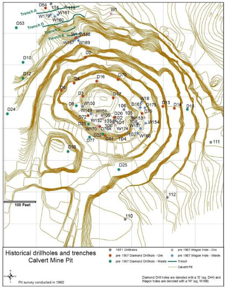
In 1967, an evaluation by Mining Geologist Norman E. Ebbley for Minerals Engineering Co. reviewed the various proposed mining methods for developing ore below the 6990 ft elevation and determined that the underground tunnel under development should be abandoned at its current position, 225 feet from the tunnel entrance due to difficult ground conditions. In his report Mr. Ebbley proposed several alternative mining methods and the associated costs for the extraction of the ore blocks defined below the bottom of the pit including the sinking of a shaft from surface, spiral berm stripping method and the utilization of a surface tram. Surface diamond drilling continued in 1967 evaluating extensions to the previously defined ore blocks below the open pit.
The US Bureau of Mines Mineral Yearbook for 1971 briefly describes the work completed by Minerals Engineering Co. at their Calvert Mine site in 1971. The summary of activities states that more than 2,500 feet of diamond drilling was completed in and adjacent to the Calvert Mine in December 1971. Seven of 10 core holes drilled in the mine intersected ore-grade material. A total of five (5) core holes were located adjacent to the mine, three of which located to the southeast did not encounter ore grade material. The remaining two (2) holes were located to the north-northeast of the mine intersecting high grade tungsten mineralization. Additional holes planned to follow up on these high grade intersections were delayed by heavy snows and further exploration would be delayed until the spring of 1972. This is the last exploration drill program documented on the property.
Calvert Mine Outlook
Based on review of previous operator reports, documentation outlines 128,000 tons proven at 1.10% WO3 and 218,000 tons possible at 1.10% WO3 remaining in the open pit area. At least six zones with the potential for additional tungsten resources have been identified.
Past workers interpreted the host rock intrusion to include tungsten mineralization, suggesting the Calvert deposit may be more complicated than historically presented. Mineralization is open at depth; however, continuity requires further drilling. Historical work is limited; modern mapping, geophysics, and trenching programs are planned for the spring/summer 2025.